Custom Search
Showing posts with label Bragança District. Show all posts

Wednesday, May 15, 2019

Visiting the pedestrian route of the Forest and Biodiversity - Zoio

The walking path of the Forest and Biodiversity starts in Carrazedo and heads in the direction of Zoio. The first 700 meters coincide with the Carrazedo - Alimonde route. Soon after the beginning of the Biodiversity Station of Carrazedo, the routes separate and this one goes in the direction of the Site of the Pombeira, entering a wood of negral oak. You will pass the Florestal House of Pombeira and finish the forest, followed by agricultural paths to the village of Zoio. After visiting the village, take the direction of Martim, and when you reach Casa Florestal, return to Carrazedo by forest path.

Monday, May 6, 2019

Visit the Railway Station of Sendas

Sendas Railroad Station, originally known as Quintella, was a gauge of the Tua Line, which served as the town of Sendas, in the Municipality of Bragança.
In July 1905, work on the Tua Line ran very fast, and it was hoped that at the end of September or early October it would arrive at Quintella station, next to Valdrez and Sendas. However, this section only entered service on 18 December of that year, while the next section, until Rossas, entered the service on 14 August 1906.
In 1939, the National Railway Company made restoration works at this station.

Sunday, April 21, 2019

Tuesday, April 16, 2019

Visit the Living Science Center of Bragança - (Sé) Bragança

The Living Science Center of Bragança, located in the parish of Sé, is part of the network of Centros Ciência Viva, focused on energy and environmental issues.
The center is divided into two buildings: an old hydroelectric power station on the left bank of the Fervença river and the so-called "Casa da Seda" and an old hydraulic mill. The "Casa da Seda" incorporates air conditioning systems that maximize natural heating and cooling capacity.
The permanent exhibitions are presented in modules, dedicated to energy, the environment, recycling and silk production.

Wednesday, April 10, 2019

Visit the Church and Convent of São Bento - Santa Maria (Bragança)

The Church of São Bento, located in the parish of Santa Maria, Bragança, is part of a convent founded in 1590 by order of D. Maria Teixeira, occupying the houses that belonged to it. Even today, the stones of arms visible in the facade of the temple and the pediment of baroque style are visible. In the interior the ceiling of the vaulted nave stands out, with paintings by Manuel Caetano Fortuna, the chapel with altarpiece of 1721 and the ceiling that boasts an excellent scenic painting, using the Trompe-l'oeil technique.

Tuesday, August 21, 2018

Visit the River Pepim - Aveleda (Bragança)

The River Pepim, is born in Spain, and after crossing the Parish of Aveleda, will empty into the River Sabor.

Friday, July 27, 2018

Visit the mountain bike course of the Municipality of Bragança

The mountain bike route of the Municipality of Bragança begins in the city of Bragança, in the historical center, next to the Castle. From where you can see the Serra de Montesinho, where it follows the percuros. The entrance to the Natural Park is soon in Gimonde at 6km.
In Quintanilha is the Apples River, bordered by Spain. This is an area full of old water mills and water mills. Continuing along the route to the north, one arrives at the village of Rio de Onor, one of the last transmontanese community villages. In this border village, goods are still shared within the community, such as the community oven, cattle or even land. The crossing of the River Onor is through a Roman Bridge, after which it continues south towards the villages of Varge and Aveleda. Again next to the border, we can see what remains of the Mineiro de Portelo Complex, now inactive. A few kilometers later you come to the village of Montesinho.
Subsequently, it goes to the Serra Serrada dam, one of the highest points of the course, circling the 1300 meter altitude.
Further south, in the village of Portela you can visit the Interpretive Center of Nature and get to know the fauna and flora of the region better. In the next 28 km you descend almost 1000 meters of unevenness, but in the next 26 km you will climb them again, arriving at the Sanctuary of Mrs. da Serra in the middle of Serra da Nogueira. This will probably be the most demanding part of the route, but the view is well worth it.
You reach Izeda, the southernmost point of the route. On leaving this village you will pass a remarkable olive grove, in the direction of Coelhoso, where you can contemplate another Mining Complex: Minas de Ribeira, with particular interest in the bridge that was used by the miners to reach Outeiro. After passing through Grijó de Parada, Freixedelo and Alfaião, one arrives again at Bragança, with about 255 km elapsed.

Thursday, July 26, 2018

Visit the Natural Park of Montesinho

The Natural Park of Montesinho is located in Trás-os-montes, abragendo the Municipality of Bragança, and the one of Vinhais. It has about 75 thousand hectares. Temperatures range between -12 ° C and 40 ° C.
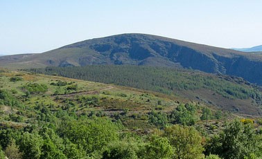
It has a heterogeneous relief, with plateaus cut by deep valleys, as well as some mountain ranges, of which stands out the Serra de Montesinho, in the county of Bragança. The altitudes vary between the 1486 meters, in the Mountain range of Montesinho and the 438 meters in the bed of the river Mente.
Shales are the dominant rocks, but granites, ultrabasic rocks and small calcareous stains can still be found.
The Natural Park of Montesinho is crossed by some of the most important water courses of the river basin of the Douro River.
In the area of ​​Bragança, there are the rivers Sabor, Maçãs and Baceiro. Sabor is born on the border with Spain, on the summits of the Sierra de Montesinho, passing a short distance from Bragança. The Apples is born in Spain, and makes the international border in two distinct stretches. Baceiro is also born in Spain, being the smallest of the main rivers, in its route there is an important nursery of trout.
There is a great diversity of fauna and flora in the Natural Park. The heaths, steels and giests, commonly called matos, occupy vast territories of abandoned soils for agriculture, borders of forests or lands once occupied by an autochthonous forest. The matos, and particularly those occurring at higher altitudes, are biotopes of extreme importance for several species of wild fauna. Lameiros, also known as meadows or mountain pastures, are associated with most of the riverine areas. Chestnut groats represent the majority of agricultural land. Holm oak forests, known as Sardinian forests, occur in the lower areas. Finally, oak-negral forests are one of the main types of native tree vegetation that occurs in the Park as part of a continuum that extends south to the Nogueira mountain range.
The Natural Park of Montesinho has about two hundred and fifty species of vertebrates and a high wealth and diversity also of invertebrates.
The presence of the Iberian wolf, the deer, the water mole, the wild cat, the big horseshoe bat and the mouse-de-lameiros stands out. There are about 160 species of birds, including the royal eagle and the black stork.

Saturday, May 29, 2010

Visit the Chapel of Our Lady of Costa - Pebble Ansiães

The Chapel of Our Lady of Costa atop a hill as steep and sharp, to the west of the village Pebble Ansiães, whose pine-covered slopes.
It is the Chapel of the procession begins and ends Senhora da Costa.

Monday, May 24, 2010

Visit the Church of Marzagão

The Church of Marzagão is constructed of granite bell tower and a central atrium that has two cypress trees in front hiding a little old and monumental beauty of the building. Inside, beyond the rich gilded baroque and renaissance in front of three altars, has panels on the ceiling of the Chancel with 45 tables and the Body Temple with 99.

Thursday, May 20, 2010

Visit Foz Tua - Chestnut

The Foz Tua, is located in the Town of chestnut among the Counties of Carrazeda de Ansiães, Alijó and Sao Joao da Pesqueira, framed by the bridge's rail line and flows into the Douro River Douro. With a typical landscape of Douro.